 Mobile device
Information
English (United Kingdom) English (United States) Deutsch (Deutschland) Español (España Alfabetización Internacional) Français (France) Italiano (Italia) Português (Portugal) Русский (Россия)
Description
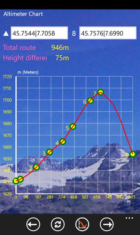
Altimeter Chart Professional is a useful and versatile tool for hiking or cycling and Alpine routes . It includes the following tools: - Recognition and memorization of the actual path through the GPS - Recognition and memorization of a virtual path map - Altimeter chart of the real route and / or virtual path - Dashboard of calculating time, distance and speed - Compass - Setting units of measure
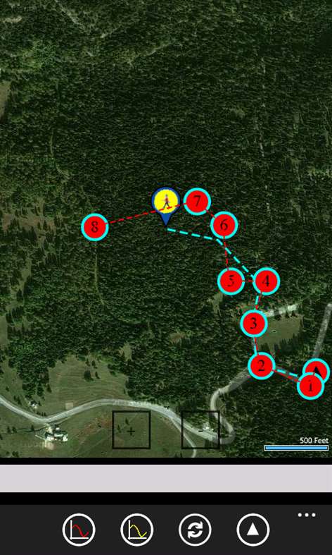
The application measures and calculates the elevation relief of a path on trails or roads, or a virtual path between N points of the terrain, with N from 2 to 99 marked on the map , even at a great distance , can also perform measurements between points not visible from one another , for example between a mountain and the other , and also measure the depth of the sea .
Compute the distances between the points marked on the map and calculates the Cartesian curve of heights measured in meters or feet, as set in the page "Settings".
At the same time it checks the phone's location and measured the elevation of the relief route taken by the phone. If the virtual path and the path of the phone starting from the same point, you can see the difference in elevation between the 2 routes , the virtual and the real .
The dashboard displays the positions , the distance and speed of the owner of the phone.
The compass detects the earth's magnetic north and true north .
The virtual path can be stored in memory and subsequently taken up with the " Save" and " Resume " .


