 Mobile device
Information
English (United States) Català (Català) Deutsch (Deutschland) Español (España Alfabetización Internacional) Suomi (Suomi) Italiano (Italia) Nederlands (Nederland)
Description
** Now with live tile, showing your track stats live on your startscreen **
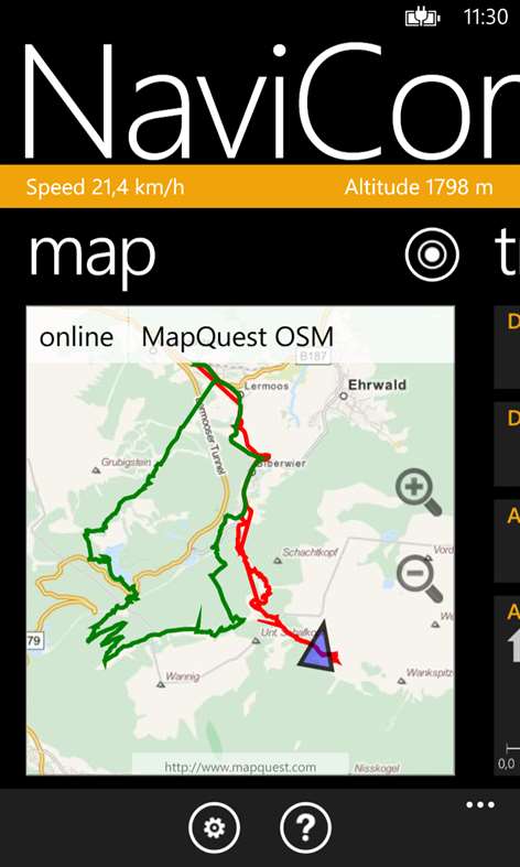
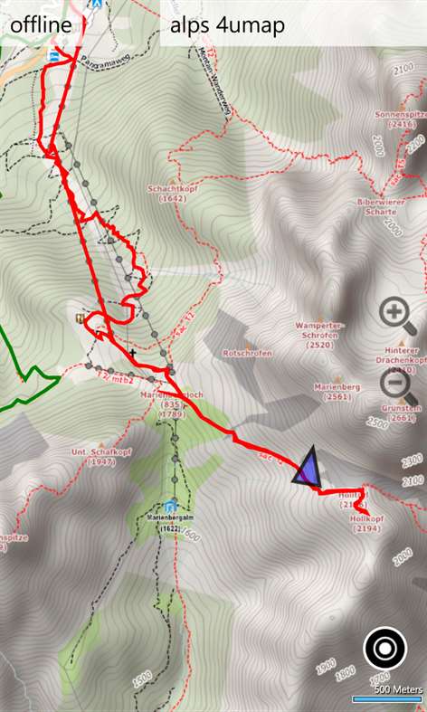
NaviComputer is a GPS offline maps and tracking app designed for hiking, biking and other outdoor activities. It uses different variants of OpenStreetmaps optimized for hiking and biking and can be extended with custom map sources.
Bundled with the optional map downloader and file synchronization tool NaviMapper for desktop PCs, it is optimized for offline use when you are abroad or in regions without network coverage. You can download NaviMapper on the website at www.navicomputer.com
NaviComputer can track your routes in the background and save them in the common GPX file format, as well as import GPX files from everywhere on your phone.
The new live tracking feature can save your life in emergency situations by transmitting your position in real-time or simply allowing your friends to follow your exciting trips.
- Topographic offline maps, easy downloadable and manageable - Trackrecording with statistics and GPX capabilities - Optional PC tool for downloading maps and transfering offline maps and GPX tracks from and to the phone. - SkyDrive / OneDrive import and export of GPX tracks and offline maps - Live tracking: Share a link with other people to let them follow your trip live on a map - Simple and easy userinterface, adapts to your phone's design theme
For further information, please visit our website at www.navicomputer.com and do not hesitate to contact us.
Please note: Even though the name may be misleading a little bit, NaviComputer is not intended to be a turn-by-turn navigation app for in-car use.
People also like
Reviews
-
2/9/2015by Joe
Great job, but not even close to the functionality of the WM6 edition! Drag and drop to phone memory will be impossible due to WP limitations. Features I relied on don't exist with this version, such as... Bookmarks (waypoints), a compass with waypoint enabled, auto loading lower res maps of a different type for the same location. Get yourself an old WP6.5 phone (HTC HD2) and treat yourself to what this developer had accomplished before MS locked access to the OS.
-
9/15/2014by Wilson
Very good quality app..next step is to allow manual coordinate input to generate trail..cheers for the developers!
-
10/29/2015Really by Patrick
Really good maps, shows most trails and is easy to see in the daylight
-
9/14/2015by Mike
Excellent backcountry navigational tool, easy to use yet very sophisticated functionality.
-
7/13/2015Awesome! by Darrin
This app works great for hiking, running... Etc. The ability to save maps offline and put multiple tracks on the map was a huge plus!!!
-
10/28/2015by Angelariy
Does what is expected. UI could be simplified a bit, I like my old Garmin Legend handheld interface - default my track on the map, compass, fishing times, sunset time, # satellites and signal strength plus accuracy circle. Good on battery! Works well so far (used 1 day).
-
7/4/2015by ADRI
Almost perfect!! because there is always something to improve! working well in the Austrian alps!! +++++
Articles
Top downloads
New and rising apps
Best-rated apps
- 3 Reitit
- 4 Street Views
- 5 MyLocation
- 6 SatelliteMap
- 7 Compass
- 8 Geo Converter (Lite)
- 9 Photo Editor India
- 10 Road Trips


