 Mobile device
Information
Dansk (Danmark) English (United States)
Description
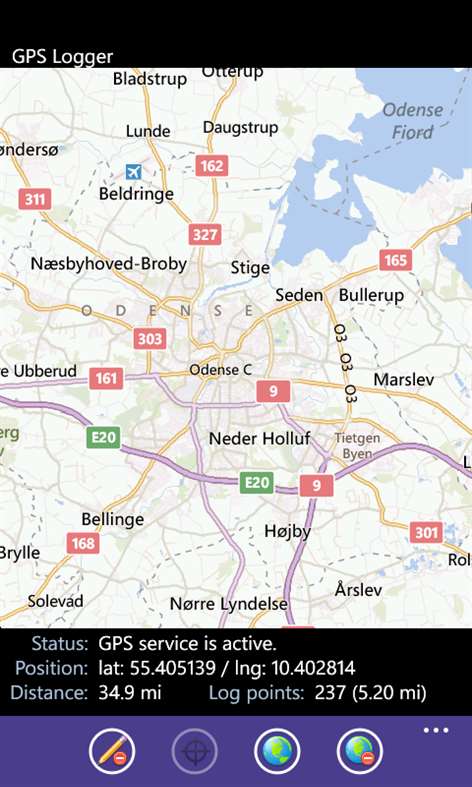
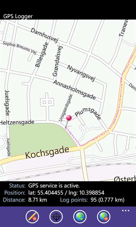
Log your route to a csv file and upload it to your SkyDrive account for later use (eg. for photo tagging). In the app you can set whether you allow sharing of your location. If yes, then you can follow your route on a map. If you do not allow sharing of your location, it will only be this feature that is disabled. All remaining functionality is retained. If you simply want to log your route, you can disable the map, so you don’t have data usage. Features: • Decide whether you want to share your location (the app will retain as much functionality as possible). • Set how large a position change is needed, to trigger a logging / display on the map. • Set default if they map should load on app start or not. • Show/hide map. • Switch between road map and satellite map. • Set the map default zoom level. • Follow your route on the map (only function that requires you to share your position). • Shows distance moved since app start. • Logging of route. During logging it shows the number of log points, and the distance logged (km / mi). • Uploading GPS data file to your SkyDrive account. (with automatic LogIn after you first access.) • Delete GPS data file from the phone. • Select if you want log points drawn on the map (no / always / only when logging) • Position (Latitude / longitude) is displayed in decimal format • Run the app under phone lock screen. • Turn off phone lock screen. • Switch between showing the distance in kilometers / miles. Note When the app starts, the map is loaded for the position where you last used the app. (When a new position is gathered by the GPS the map will switch to your current location). If you experience a poor accuracy then this is due to the GPS in your device or due to bad connection to the GPS Sattelites, and has nothing to do with my app – so please don’t give bad ratings because of this ;) Feedback is welcome via the support email. Problems, errors, suggestions to improvements?
People also like
Reviews
-
6/17/2014by User
The app is very good overall. It would be nice if the .csv file included elevation. It would also be nice if the file names output were unique, using date and time maybe? Otherwise it does everything I need it to and doesn't kill my battery!
-
10/18/2015good app by Bert
Good app, could be extended to gpx for including height readings and gpx trail display. CSV values are rounded/truncated instead of padded with trailing zeros to keep the same amount of decimal places.
-
12/5/2013by Jim
Seems to do what I want, but no e-mail/support provided. I have some questions.
Articles
Top downloads
New and rising apps
Best-rated apps
- 3 Reitit
- 4 Street Views
- 5 MyLocation
- 6 SatelliteMap
- 7 Compass
- 8 Geo Converter (Lite)
- 9 Photo Editor India
- 10 Road Trips

